Penyagolosa Hiking Guide 2026: The Honest Mountain Walker's Manual
Penyagolosa (1,813 m) is the most emblematic mountain in the Valencian Community — visible from much of inland Castellón province, recognisable by its distinctive isolated rocky summit, and the focus of one of Spain's oldest annual pilgrimages. Technically the second-highest peak in the wider Valencian Community (Cerro Calderón at 1,839 m in the Rincón de Ademuz exclave is taller), but the cultural and visual centre of the regional mountains. The honest 2026 guide to the hike.
Mountain-focused trip arrivals
Penyagolosa is 2 hours' drive north of Valencia city, accessible via the Castellón provincial roads. For visitors making Penyagolosa the centrepiece of a 3-4 day Castellón mountain trip, arrival into Valencia (VLC) or Castellón-Costa Azahar (CDT) airports works well. JetLuxe handles light and mid-size jets directly into both with FBO transfer. JetLuxe quotes the common European city pairs in 90 seconds.
Search Charter Flights →Penyagolosa in context
Penyagolosa (in Valencian, Penya-Gol-Osa; in Spanish, Peñagolosa) is the cultural high point of the inland Valencian Community mountains — the peak that locals consider their own, the peak that anchors centuries of pilgrimage tradition, and the peak with the most-distinctive isolated profile across the wider region. The headline facts:
- Elevation: 1,813 m above sea level. Often crowned with snow November through March.
- Geological position: Eastern end of the Sistema Ibérico (Iberian System) mountain range, in the Alcalatén area of Castellón province.
- Symbolic status: Often referred to as 'the roof of the Valencian Community', even though it is technically the second-highest peak (Cerro Calderón at 1,839 m in the Rincón de Ademuz Valencian exclave is marginally taller).
- Natural park status: Protected as the Parc Natural del Penyagolosa, 1,094 hectares of protected land, declared in 2006.
- The Sant Joan pilgrimage tradition: Five formal annual pilgrimages converge on the Sant Joan de Penyagolosa sanctuary at the foot of the mountain, including the UNESCO-recognised Els Pelegrins de les Useres.
- Geological isolation: The peak rises substantially above the surrounding terrain — its distinctive profile is recognisable from over 50 km away on clear days.
The Cerro Calderón comparison
Some clarification on the 'highest peak' question. The Valencian Community technically has three or four peaks higher than 1,800 m:
- Alto de las Barracas / Cerro Calderón (1,839 m) — the actual highest, in the Rincón de Ademuz exclave (a small piece of Valencian territory surrounded by Aragón and Castilla-La Mancha). Less visited because of its remote location.
- Penyagolosa (1,813 m) — the emblematic peak, in Castellón province.
- Several smaller 1,500+ m peaks — mostly in the Rincón de Ademuz and the inland Castellón mountains.
The cultural status of Penyagolosa as the 'Valencian high point' predates the geographic awareness of Cerro Calderón's slightly greater elevation. Modern hiking and geographic literature increasingly acknowledges Cerro Calderón as technically higher, but Penyagolosa remains the symbol — the peak that appears in literature, art, postcards, and the regional identity.
Getting to Penyagolosa from Valencia
The only realistic approach is by car. The standard route:
From Valencia city
- 1. Valencia to Castellón: A-7 motorway north, 65 km, about 50 minutes.
- 2. Castellón inland: CV-10 toward the inland mountains via Alcora, 35 km, 35-45 minutes.
- 3. To the Penyagolosa area: via Vistabella del Maestrazgo (the most-used approach), 30-40 km on the smaller mountain roads, 45-60 minutes.
- 4. Final approach: from Vistabella to Sant Joan de Penyagolosa sanctuary parking, about 8 km on a smaller road, 15-20 minutes.
Total drive from Valencia city to the parking: 2 hours 15 minutes typical, 2.5 hours with mountain-road conditions.
Parking at Sant Joan
The parking is at the small village of Sant Joan de Penyagolosa (1,235 m elevation), adjacent to the sanctuary. Free parking; capacity for around 80-100 cars. On peak hiking weekends (April-October Saturdays and Sundays), the parking fills by 10:00 — arrive by 09:30 to secure a space. Overflow parking is along the access road; walk an extra 5-10 minutes from the further parking points.
Alternative starting points
- Vistabella del Maestrazgo — start the walk from the village itself, adding about 3-4 km to the standard route. Suitable for visitors staying overnight in Vistabella.
- Villahermosa del Río — alternative starting village 12 km southwest of Vistabella. Adds more distance; less commonly used.
- Atzeneta del Maestrat — eastern approach. Different route to the summit; longer and more technical.
Sant Joan de Penyagolosa — the start
The Sanctuary of Sant Joan de Penyagolosa is at 1,235 m elevation, at the foot of the mountain. The complex includes:
The sanctuary itself
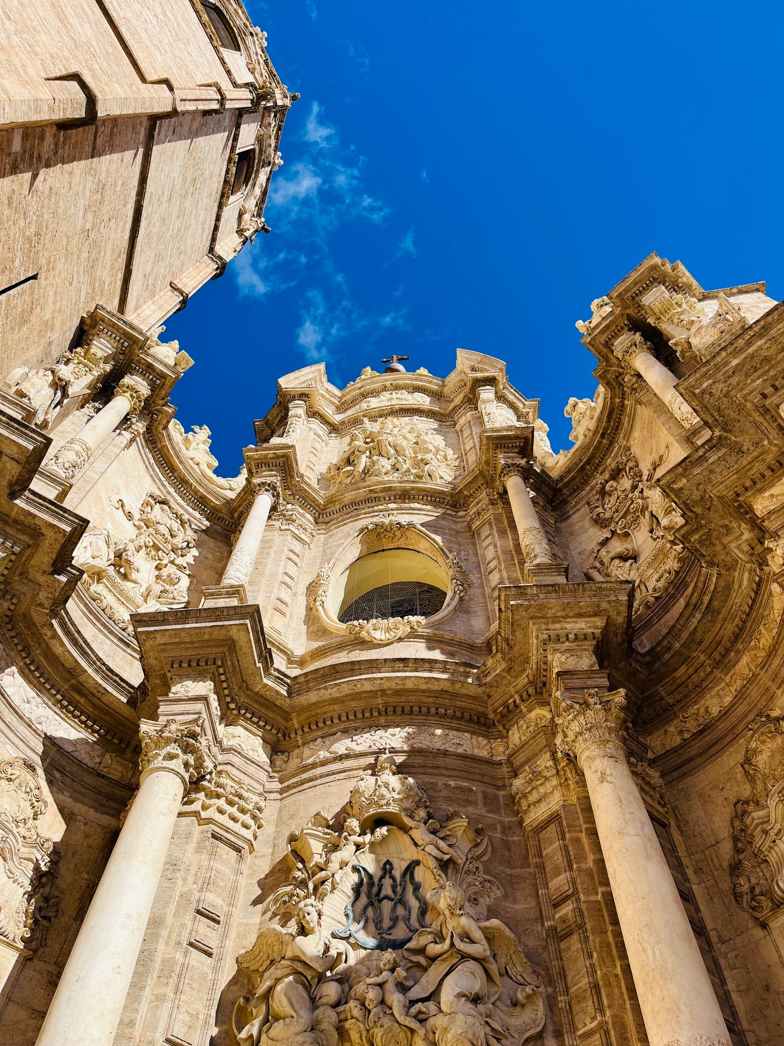
A medieval hermitage building of Gothic origins, with the current structure largely rebuilt in the 17th-18th centuries. The chapel is small and simple inside — whitewashed walls, modest religious decoration, a small altar. Open at variable hours for visits; reliable opening during the morning. Worth visiting for the historical context and the cool stone interior on a hot summer day.
The five annual pilgrimages
The sanctuary receives five formal pilgrimages each year, of which the most famous is the Els Pelegrins de les Useres:
- Els Pelegrins de les Useres — eight-day annual pilgrimage from the village of Les Useres (Castellón) to the sanctuary, dating from at least the 14th century. Recognised as UNESCO Intangible Cultural Heritage. The pilgrimage involves around 24 male pilgrims walking the round trip with specific ritual stops. Held in late April / early May annually.
- Pilgrimage from Teruel province — annual pilgrimage from across the regional border.
- Three other smaller annual pilgrimages from various local villages.
The refugio
A small mountain refuge near the sanctuary offers basic overnight accommodation for serious hikers and pilgrims. €15-€25 per night for a bunk; meals available at the adjacent restaurant. Limited capacity (around 30 beds); book ahead.
Small restaurants
Two or three small restaurants at Sant Joan serve traditional mountain cuisine — typically simple local dishes including grilled meat (lamb chops, chuletas), local stews, and traditional desserts. Reasonable prices (€15-€25 per person for a full meal). Worth the post-hike lunch stop before the drive back.
The standard ascent route
Route overview
- Start: Sant Joan de Penyagolosa parking (1,235 m).
- Summit: Penyagolosa (1,813 m).
- Total elevation gain: 550-650 m depending on exact route.
- Total distance: 14-16 km round trip (the standard circular).
- Time: 4-5 hours at moderate pace, including summit time.
- Difficulty: Moderate — requires fitness and some scrambling on the upper sections.
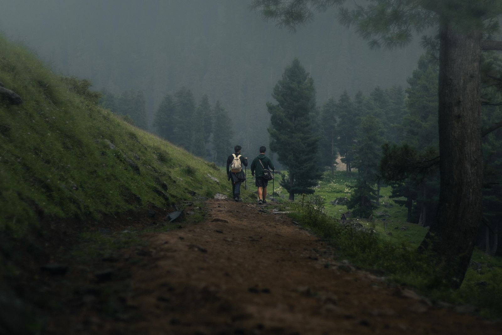
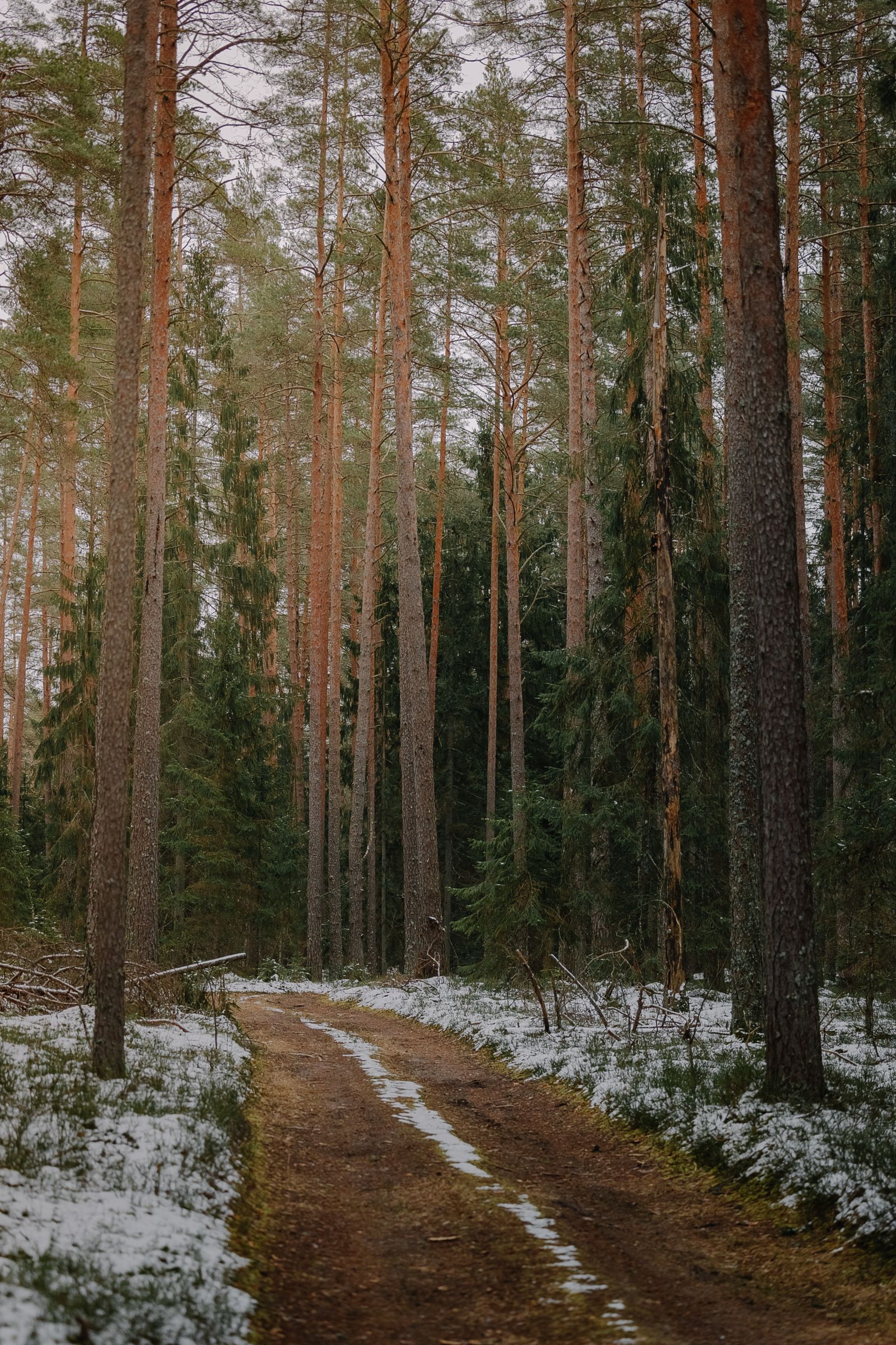
Stage 1: Sanctuary to lower pine zone (km 0-3)
The first section follows the GR-7 long-distance trail through pine forest. Gentle gradient, well-graded path. Allow 45-60 minutes to cover this section.
Stage 2: Lower pine to upper treeline (km 3-6)
Steeper gradient as the trail climbs through the upper pine zone to the treeline (around 1,500 m). The path becomes more rocky and exposed. Allow 45-60 minutes.
Stage 3: Treeline to summit ridge (km 6-7.5)
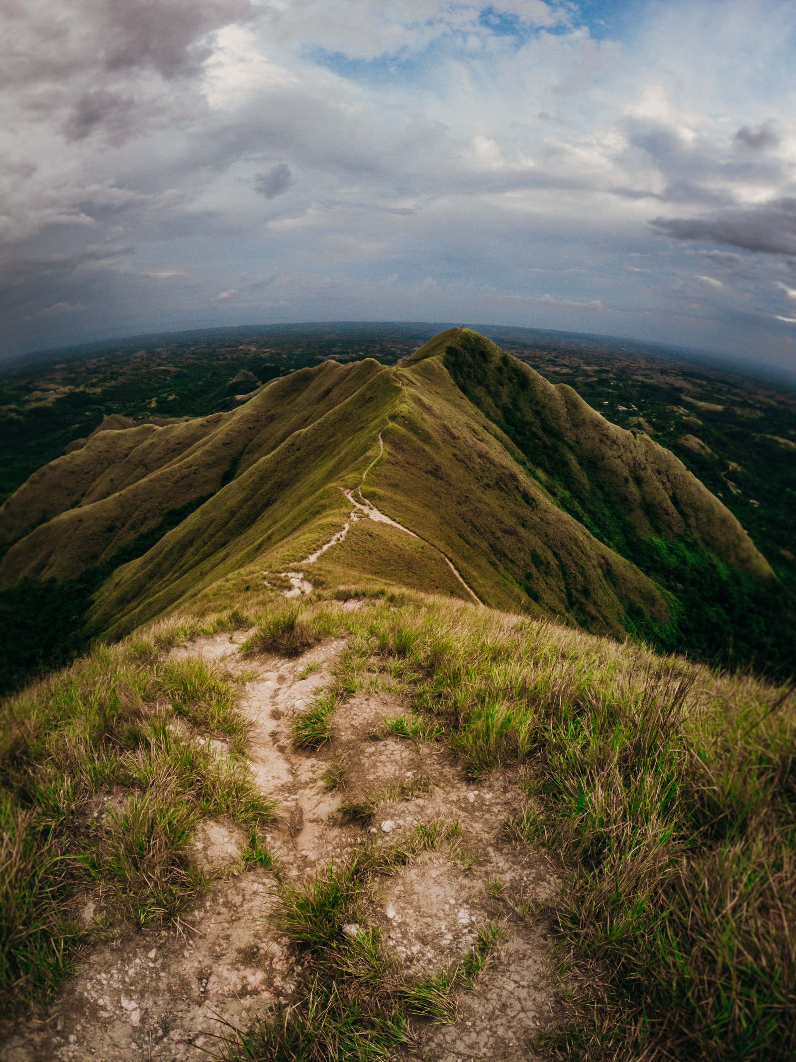
Above the treeline, the vegetation transitions to alpine-style scrub — creeping juniper (Juniperus sabina), Erodium celtibericum (the endemic Penyagolosa herb), nun's cushions. The summit ridge is rocky with some scrambling required. Allow 45-60 minutes for this section.
Stage 4: Summit (km 7.5)
The summit itself has a small shrine to Sant Joan and a wardens' hut (rarely staffed). The view extends across multiple provinces on clear days — Castellón to the east, Valencia and Alicante to the south, Teruel to the west, and Tarragona to the north. Five provinces visible on the best days. Allow 30-45 minutes for summit time.
Stage 5: Descent via Barranco de la Pegunta (km 7.5-15)
The standard circular descent is via the Barranco de la Pegunta — a ravine on the south-east side of the mountain, with running water (in spring and after rain), more vegetation, and a different scenic character from the ascent. The descent is around 7 km back to the sanctuary, taking 1.5-2 hours.
Multi-day mountain trips combining Penyagolosa with the wider Castellón mountains
Penyagolosa is one of multiple serious mountain targets in inland Castellón province — combined with the {internal('valencia-sierra-espadan-natural-park-guide-2026', 'Sierra de Espadán')}, the upper Sierra Calderona, and the inland mountain villages, a 3-4 day Castellón mountain trip covers significant terrain. Arrival into Valencia (VLC) or Castellón (CDT) airports works well for these trips. JetLuxe handles light and mid-size jets directly with FBO transfer. JetLuxe quotes the common European city pairs in 90 seconds — useful for groups travelling with mountain gear.
Search Charter Flights →Other route variants
The north face scramble
An advanced variant ascends Penyagolosa via the north face channel — a steeper, more technical route involving moderate scrambling. Around 16-18 km circular, with significant exposure. Suitable only for experienced mountain hikers; some guidebooks describe it as 'mountain goat territory'. Not recommended without local knowledge.
Penyagolosa + adjacent peaks
The summit has two adjacent peaks — the main Penyagolosa summit and a slightly lower secondary peak. A leisurely stroll between them adds 15-20 minutes and gives different viewing angles. Worth doing if time and energy allow.
The pilgrimage route variant
For visitors interested in the cultural context, the pilgrimage routes from Les Useres or other villages can be walked in segments. The full Pelegrins de les Useres route is 35+ km, but shorter day-walk segments are accessible. The Camino de Santiago de Levante guide covers the wider pilgrimage tradition in the Valencian Community.
The Vía Verde extension
For visitors combining the hike with cycling, the Vía Verde de Ojos Negros runs through the wider Castellón mountain region and connects to the Penyagolosa area via secondary routes.
When to climb
| Season | Summit conditions | Verdict | Notes |
|---|---|---|---|
| January-February | Snow, ice common | Mountaineering only | Crampons, ice axe required |
| March | Snow remnants possible | Variable | Check conditions; weather window |
| April | Generally clear, possible storms | Good | Spring flowers begin |
| May-June | Excellent, wildflowers | Strongest window | Long days, mild temperatures |
| July-August | Hot at base, cooler at summit | Workable, start early | Crowded weekends |
| September-October | Excellent, autumn colours | Second strongest window | Cooler, fewer crowds |
| November-December | First snow at summit | Variable | Check conditions weekly |
The single best window: late May to mid-June. Wildflowers at peak, summit clear of snow, longer daylight, mild temperatures. Avoid the height of summer (mid-July to mid-August) when crowds peak and lower-elevation heat is uncomfortable.
Preparation and gear
Fitness level
Penyagolosa is a moderate-to-hard mountain hike, not technical climbing. Preparation:
- Cardio fitness — sustained 4-5 hours of uphill walking at altitude (up to 1,813 m). Comparable to a 1,000 m climb in the Alps or Scottish Highlands.
- Leg strength — the descent via the Barranco de la Pegunta involves substantial knee impact over 1.5-2 hours.
- Hiking experience — comfort on rocky terrain and modest scrambling. Not technical but not a paved path.
- Recommended preparation — multiple 10-15 km training hikes with elevation gain in the month before the trip.
Gear
- Hiking boots — mid-weight, with grip for rocky terrain. Trail-running shoes adequate for fit hikers in dry conditions.
- Backpack — 20-30 litres, enough for water, snacks, layers, first aid.
- Water — 2-3 litres per person for the full hike. No reliable water on the route.
- Sun protection — hat, sunglasses, sunscreen. The upper sections are exposed and the altitude increases UV intensity.
- Layers — temperatures at the summit can be 10-15°C cooler than at the trailhead, with significant wind. Lightweight fleece and wind layer recommended.
- Rain gear — afternoon thunderstorms develop quickly in summer; lightweight waterproof recommended.
- Hiking poles — recommended for the descent; reduces knee impact significantly.
- First aid kit — basic blister care, painkillers, antihistamines.
Planning a Penyagolosa visit
Three working patterns for Penyagolosa hikes:
The full day-trip from Valencia
Depart Valencia 06:30-07:00, hike Penyagolosa 09:30-16:00, lunch in Vistabella 16:00-17:30, return to Valencia by 19:30-20:00. Total day 13-14 hours. Feasible but long. Cost €60-€120 per person for car, lunch and incidentals.
The overnight in Vistabella / Villahermosa
Stay overnight in Vistabella del Maestrazgo or Villahermosa del Río the night before (or after) the climb. The mountain villages offer small rural-tourism hotels (€60-€120 per night) and traditional restaurants. The overnight option gives more relaxed timing and access to a slower paced mountain experience. Total trip cost €200-€400 per person.
The multi-day Castellón mountain tour
3-5 day trip combining Penyagolosa with other Castellón mountain experiences — the Sierra de Espadán Natural Park, the historic mountain villages, the Vall de Almonacid olive oil region. Suited to outdoor-focused trips making mountain hiking the central activity. Total trip cost €500-€1,200 per person.
The wider context of Valencian mountain hiking sits alongside the Sierra Calderona hiking guide (the closer, easier mountain area), the Valencia day hikes guide (for the broader hiking options), and the Camino de Santiago de Levante guide (for the pilgrimage tradition that Penyagolosa anchors).
Penyagolosa is one of the most distinctive single peaks in eastern Spain — a clear-day visible landmark from over 50 km, a pilgrimage focus with 700+ years of tradition, and a serious-but-not-technical hiking objective for visitors with the time and fitness. For visitors wanting to extend beyond the standard city-and-coast Valencia trip into a genuine mountain experience, Penyagolosa rewards the effort.
Common questions
Penyagolosa (1,813 m) is the most emblematic and culturally significant peak in the Valencian Community, but it is technically the second-highest. The actual highest peak is Cerro Calderón at 1,839 m, located in the Rincón de Ademuz — a small Valencian exclave in Cuenca province, geographically separated from the main Valencian Community territory. For most practical purposes (visibility, accessibility, cultural weight, hiking interest), Penyagolosa is treated as the regional high point and the symbolic 'roof of the Valencian Community' even though Cerro Calderón is slightly taller. The Penyagolosa-as-symbol tradition predates the formal recognition of Cerro Calderón as technically higher.
The standard route starts at the Sant Joan de Penyagolosa sanctuary (1,235 m elevation) and ascends to the summit at 1,813 m. The standard circular route is 14-16 km with about 550-650 m of elevation gain, taking 4-5 hours at moderate pace. The route follows the GR-7 trail for part of the ascent, climbs through pine forest to the rocky upper slopes, and reaches the summit via the eastern ridge. The descent is typically via the Barranco de la Pegunta ravine. The route is well-marked but the upper sections involve some moderate scrambling on rocky terrain. Suitable for fit walkers; not technical climbing.
Drive — there is no realistic public transport option. The route from Valencia city: take the A-7 north to Castellón, then the CV-10 inland toward the mountains. The final approach is via Vistabella del Maestrazgo or Villahermosa del Río to the Sant Joan de Penyagolosa sanctuary parking area. Total drive: approximately 2 hours 15 minutes, about 130-150 km. Parking is at the small village of Sant Joan de Penyagolosa (the parking partway up the mountain was closed when the area was designated a protected natural park; vehicle access is now restricted). Allow extra time on weekends — the parking fills up by 10:00 in peak hiking weather.
The Sanctuary of Sant Joan de Penyagolosa is a medieval pilgrimage site at the foot of the mountain (1,235 m elevation). The hermitage building dates from Gothic origins and is one of the oldest active pilgrimage sites in the Valencian Community. Five formal pilgrimages per year converge on the sanctuary, including the famous 'Els Pelegrins de les Useres' — the eight-day pilgrimage from the village of Les Useres (Castellón) to the sanctuary, dating from at least the 14th century and recognised as Intangible Cultural Heritage of Humanity. Another major pilgrimage comes from Teruel province. The sanctuary buildings include the chapel (visitable when open), a small refuge for walkers, and a small parking area. Worth visiting for the historical context even if not climbing.
May to mid-October is the realistic hiking window. Spring (May-June) is the strongest: longer days, mild temperatures (15-25°C at the trailhead, cooler at the summit), wildflowers, the snow gone from the summit. Summer (July-August) is workable but the lower elevation sections can be hot (30-35°C); start by 07:00 to complete most of the climb before midday heat. Autumn (September-mid-October) brings cooler temperatures and autumn colours. Winter (November-April) the summit is frequently snow-covered; the climb becomes a serious mountaineering challenge requiring crampons and ice axes — only experienced winter mountaineers should attempt it. Late spring and early autumn give the highest probability of perfect conditions.
Yes, but it's a long day. The full day pattern: depart Valencia 06:30-07:00, arrive Sant Joan de Penyagolosa parking by 09:00-09:30, start hiking 09:30-10:00, summit by 12:00-13:00, descent to parking by 15:00-16:00, lunch in Vistabella or Villahermosa (16:00-17:30), return drive to Valencia arriving 19:30-20:00. Total day: 13-14 hours. Suited to fit hikers with the right starting point logistics. An alternative — and meaningfully more relaxed — pattern is to stay overnight in Vistabella del Maestrazgo or Villahermosa del Río the night before or after the hike, giving longer time at the summit and more leisurely lunch options.
Sponsored · Affiliate linkMountain-focused trip arrivals work better with FBO flexibility. JetLuxe handles private charter into Valencia (VLC).
Plan Your Arrival →