Sierra Calderona Hiking Guide 2026: The Honest Walker's Manual
The Sierra Calderona Natural Park is the main accessible hiking area for Valencia city — a protected mountain range running east-west across the northern province, with the trailheads 45-60 minutes by car from the centre. Around 18,000 hectares of pine forest, Mediterranean scrub, sandstone outcrops and historic monasteries. The honest 2026 guide to the trails, the key peaks, and how to make a day-trip work.
Outdoor-focused weekend trips
Outdoor weekend trips with proper hiking kit (boots, poles, packs) sometimes exceed standard commercial luggage allowances — particularly for groups travelling with technical gear. Valencia Airport (VLC) handles light and mid-size jets directly with FBO transfer to the city in 20 minutes. JetLuxe quotes the common European city pairs in 90 seconds.
Search Charter Flights →The Sierra Calderona in context
The Sierra Calderona is the closest substantial mountain area to Valencia city — the natural weekend escape for the metropolitan population, with the trailheads accessible in 45-60 minutes by car. The park's defining characteristics:
- Location: 30-50 km north of Valencia city, straddling the border between Valencia province (south) and Castellón province (north).
- Area: Approximately 18,000 hectares of protected land.
- Elevation range: 100 m (lowest valleys) to 907 m (Gorgo, the highest peak).
- Geology: Sandstone (rodeno) outcrops are the distinctive geological signature — bright rust-red rock that gives the park its visual character.
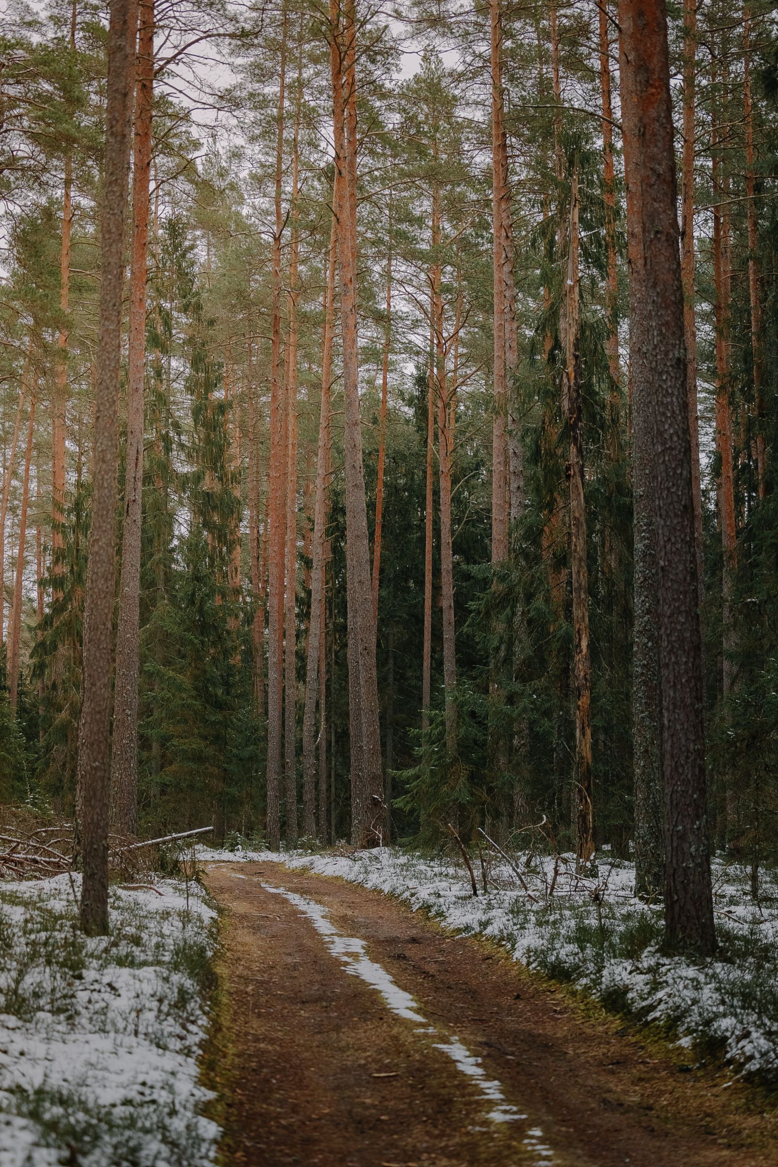
- Vegetation: Mediterranean pine forest, oak (in north-facing valleys), Mediterranean scrub (matorral), with cork oak in the higher elevations.
- Status: Declared Natural Park (Parc Natural) in 2002.
- Trail network: Around 200 km of marked trails across PR, GR-10, and SL grades.
- Villages within or adjacent: Náquera, Serra, Olocau, Marines, Segart, Albalat dels Tarongers, Estivella, Gátova, Altura.
The park's role is comparable to the South Downs for London or the Berkeley Hills for San Francisco — close enough for weekend day trips, varied enough to support multiple full-day routes, scenic enough to feel meaningfully different from the city.
The main trails worth knowing
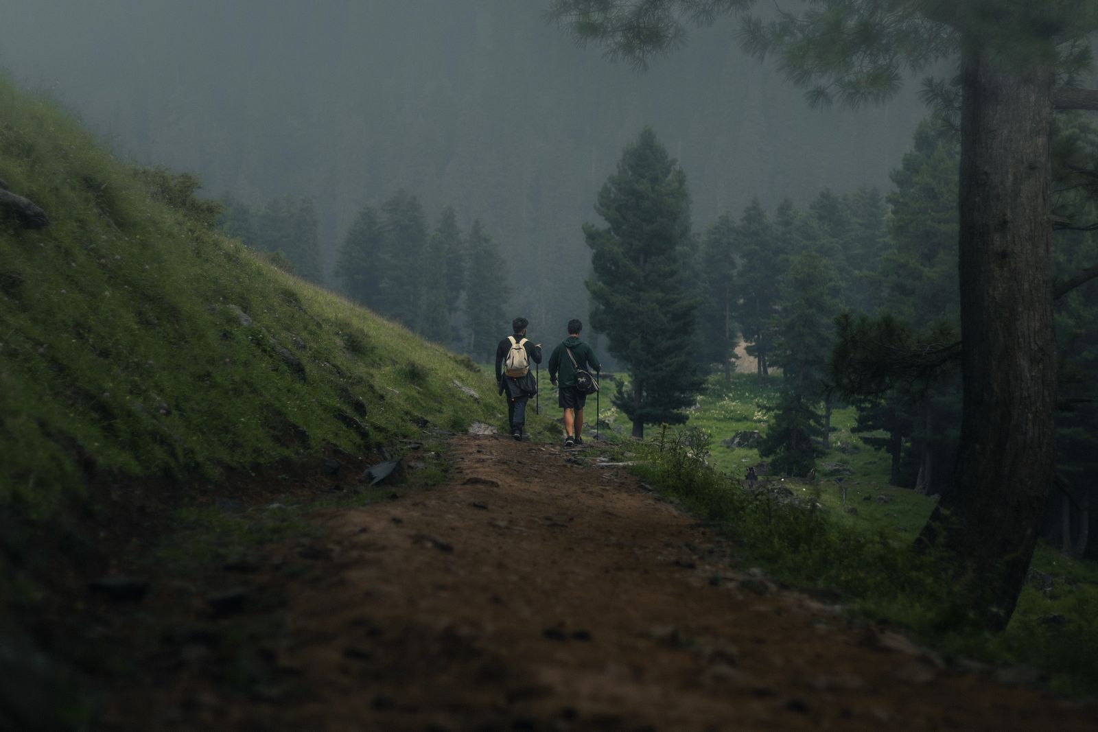
The reliable trail shortlist for visitors:
Garbí summit circular
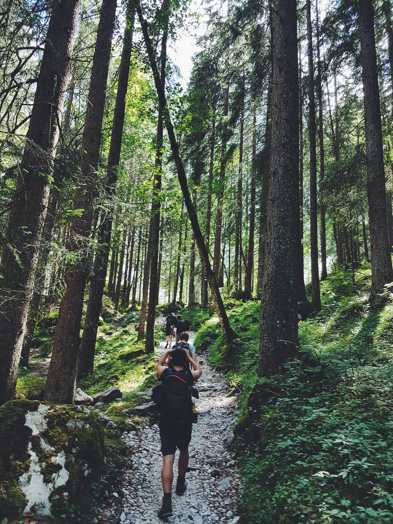
The signature hike. 8-10 km circular from Serra or the Mas de Mauro car park, with 350-450 m of elevation gain. 3-4 hours at moderate pace. Detailed in the section below.
Gorgo summit (highest peak)
The actual highest point at 907 m, but less-visited than Garbí because the views are similar but the approach is longer. 12-15 km circular from Marines, with 500-600 m of elevation gain. 4-5 hours. Good for visitors wanting more solitude than Garbí provides on weekends.
El Castillo de Olocau
Short walk from Olocau village up to the medieval castle ruin on the rocky outcrop above. 2-3 km return with 150-200 m climb. 1-1.5 hours. Perfect for visitors with limited time or as the morning warm-up before a longer hike.
La Cartuja de Porta Coeli circular
Walk from Serra through the pine forest to the external grounds of the Cartuja monastery and back via a different ridge. 6-8 km circular with 250-350 m of climb. 2.5-3 hours. Combines history with the standard pine-forest scenery.
Sendero del Rodeno (Sandstone Trail)
Specifically traverses the distinctive rust-red sandstone outcrops in the southern Sierra Calderona. 10-12 km variable routes with multiple options for shortening or extending. The most photogenic section of the park.
GR-10 traverse (multi-day)
The Gran Recorrido long-distance trail passes through the Sierra Calderona. Pilgrims and serious hikers can combine 2-3 days of GR-10 through the park, staying overnight at small village inns. Around 40-50 km of GR-10 lies within the park boundary.
| Trail | Distance | Time | Difficulty | Best for |
|---|---|---|---|---|
| Garbí summit | 8-10 km | 3-4 hrs | Moderate | First-time visitors |
| Gorgo summit | 12-15 km | 4-5 hrs | Moderate-hard | Solitude seekers |
| Olocau Castle | 2-3 km | 1-1.5 hrs | Easy | Short visits, families |
| Porta Coeli circular | 6-8 km | 2.5-3 hrs | Easy-moderate | History + walking |
| Sendero del Rodeno | 10-12 km | 3-4 hrs | Moderate | Photography, geology |
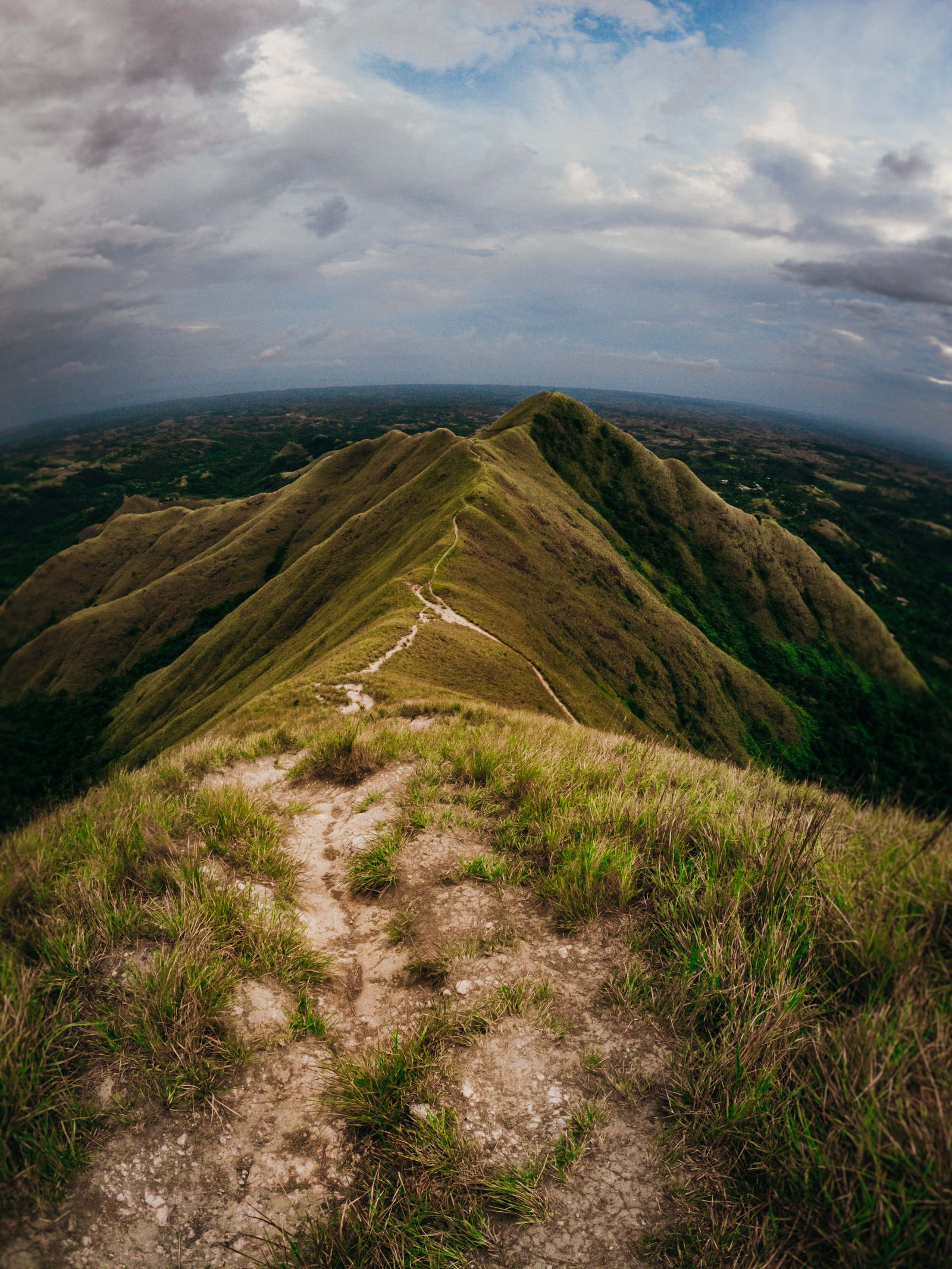
Garbí — the signature hike
Garbí is the symbolic peak of the Sierra Calderona — not the highest (Gorgo is taller at 907 m), but the most-visited and the one that gives the standard panoramic views across the Valencia coast.
The route
The standard circular ascent starts at the Mas de Mauro car park (a small parking area accessible by car via Serra). The route ascends through pine forest on the south face, traverses the summit ridge at 601 m, and descends via a different track on the north face. The full circular is 8-10 km depending on the exact variant; 3-4 hours at moderate pace including summit time.
What the summit gives you
- South view: The L'Horta plain stretching south to Valencia city — on clear days the City of Arts towers are visible 35 km away.
- East view: The Mediterranean coast — the cruise port, the beaches, Sagunto and the industrial coast north of Valencia.
- North view: The wider Sierra Calderona range — Gorgo to the west, the deep ravines of the central park.
- West view: The inland plateau toward Liria and the wine country.
The summit has a small communications mast and a stone summit pillar marking the trigonometric point. No facilities; bring water and snacks.
Practical notes
- Start time: Aim for 08:00-09:00 start in summer (heat builds quickly); 09:30-10:30 in cooler months.
- Water: Carry 1.5-2 litres per person; no water sources on the route.
- Path quality: Well-marked, well-maintained. Single-track on the upper sections, wider track on the approach.
- Parking: Mas de Mauro car park is small (15-20 cars); arrive by 09:00 on weekends to secure parking.
- Footwear: Hiking boots or sturdy trainers. No need for technical mountaineering boots.
Other peaks and routes
Gorgo (907 m)
The actual highest peak of the Sierra Calderona but less-visited than Garbí. The summit offers similar coastal panoramic views but slightly less impressive because the higher elevation means the coast is further visually. Approach from Marines via the northern trail; total 12-15 km circular with 500-600 m climb.
El Águila (Eagle Peak, 879 m)
The second-highest peak. Rockier summit than Garbí or Gorgo, requiring some scrambling near the top. Approach from Olocau or Marines; total 10-12 km with 600+ m climb. Suited to experienced hikers.
El Picaio (728 m)
A distinctive peak on the western side of the park, with the village of Serra at its base. The ascent from Serra is around 6-8 km circular with 400 m climb. Less crowded than Garbí; equally rewarding views.
The Mont Mayor and Mont Menor ridge
The two adjacent peaks (Mont Mayor 760 m, Mont Menor) on the western edge of the park. Combine in a long day hike of 14-16 km. Quieter than the eastern peaks; particularly rewarding in early morning light.
The historic monasteries
The Sierra Calderona has been a religious retreat since the medieval period. The two main monastic sites:
Cartuja de Porta Coeli
Founded 1272 by James II of Aragon, this Carthusian monastery is one of the oldest active religious houses in Valencia. Located near Serra at the southern edge of the park. The Carthusian order operates under strict monastic enclosure — only specific areas of the monastery are accessible to visitors, with guided visits available at scheduled times. The external grounds, the surrounding pine forest, and the historic walls can be walked freely. Combine with the Porta Coeli circular hike for a half-day visit.
Convento de Santo Espíritu del Monte (Gilet)
Smaller Franciscan convent on the south side of the park near Gilet. Established in the 15th century; currently active. The grounds and external chapel are accessible; the convent itself by arrangement only.
Ermitas (hermitages)
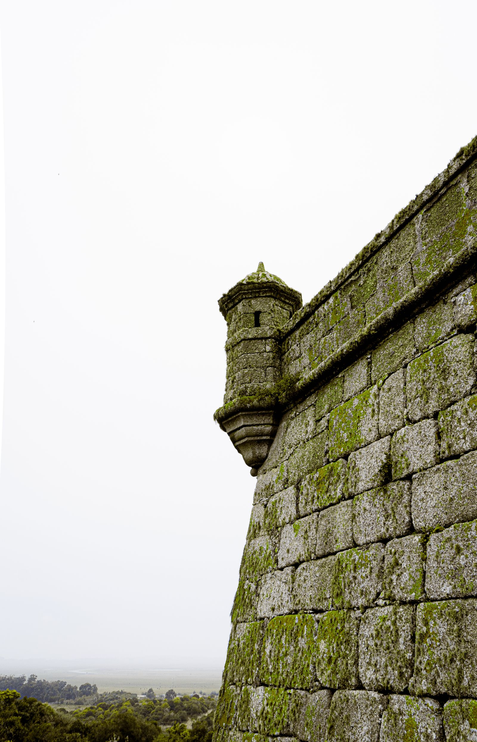
Multiple small hermitages dot the park trails — typically chapel-sized structures built between the 14th and 18th centuries as informal religious retreats. Some are restored; others are in romantic ruin. The Ermita de la Virgen del Buen Suceso (above Olocau) is the most-visited.
Outdoor-focused weekend trips with equipment
Multi-day hiking trips with proper kit — boots, poles, packs, multiple changes of clothing — quickly add up to 20-30 kg of luggage per traveller for a 3-4 day visit. Commercial luggage allowances become a friction point. Valencia Airport (VLC) handles light and mid-size jets directly with FBO transfer to the city in 20 minutes — hiking kit travels as standard cargo. JetLuxe quotes the common European city pairs in 90 seconds — useful for outdoor-focused groups travelling from Northern Europe.
Search Charter Flights →Getting there, parking, water
By car (recommended)
The standard way to access the Sierra Calderona. From central Valencia:
- To Serra and Garbí trailhead: 35 km, 45-55 minutes via the CV-310 or CV-35.
- To Náquera: 28 km, 40 minutes via the CV-310.
- To Olocau: 32 km, 45 minutes via Bétera and the CV-25.
- To Marines (for Gorgo): 40 km, 55 minutes.
All routes have free roadside or village parking at the trailheads. Arrive by 09:00 on weekends to secure parking at the popular Garbí trailhead at Mas de Mauro.
By public transport
Limited options:
- Metro line 1 to Bétera — the southernmost edge of the park access area. From Bétera, taxi to the trailheads (€10-€20 depending on village).
- Local buses — limited services from Valencia to Náquera and Bétera. Schedules vary; check Generalitat Valenciana transport website.
- Group day tours — several operators run guided hikes with transport included, €50-€90 per person for a day.
Water and supplies
Most Sierra Calderona trails have no natural water sources — bring 1.5-2 litres per person for a half-day, 2-3 litres for a full day in warm weather. Cafés and restaurants in Serra, Olocau, Náquera, and Marines provide refill options before and after the hike. The villages also have small grocery shops for trail snacks.
Mobile signal and safety
Mobile signal is good on the south-facing slopes (Garbí, Olocau) and patchy on the northern sections (Marines, Gátova). The Spanish emergency number is 112. Most popular trails are well-marked and busy enough that lost hikers are quickly found, but the more remote routes warrant the standard precautions — file a route plan, carry a charged phone with downloaded GPS tracks, bring extra water and a basic first-aid kit.
When to hike — seasonal advice
| Season | Temperatures | Conditions | Verdict |
|---|---|---|---|
| Spring (Mar-May) | 12-22°C | Wildflowers, fresh greenery | Excellent — strongest window |
| Summer (Jun-Aug) | 25-38°C | Hot, fire-risk closures possible | Avoid mid-day; early morning only |
| Autumn (Sep-Nov) | 15-25°C | Cool, occasional rain | Excellent — second strongest window |
| Winter (Dec-Feb) | 8-16°C | Mild, short daylight | Good on mild days, short hikes |
The single best month: late April. Wildflowers at peak (orchids, rockroses, irises), temperatures perfectly aligned with hiking (15-22°C), longer daylight hours, before the summer heat arrives.
Planning a Sierra Calderona day
Three working patterns:
The signature day hike
Drive to the Mas de Mauro car park at 09:00, hike the Garbí circular (3-4 hours), lunch in Olocau or Serra (1.5 hours), explore the village or visit Cartuja de Porta Coeli (1-2 hours), return to Valencia by 18:00. Total cost €30-€60 per person for car rental, lunch, and incidentals.
The two-peak weekend
Stay overnight in Olocau or Serra (small inns at €60-€120 per night) and combine Garbí (Saturday) with Gorgo or El Águila (Sunday). Suited to outdoor-focused visitors wanting more depth than a single day.
The multi-day GR-10 walk
2-3 day section walk along the GR-10 through the Sierra Calderona, staying at small village albergues. Around 40-50 km total walking. Suited to experienced multi-day hikers and as preparation for longer Spanish walks.
The wider context of outdoor activity around Valencia sits alongside the Valencia day hikes guide (covering the broader regional hiking options), the Penyagolosa hiking guide (for the more serious mountain hiking 2 hours north), and the Valencia road cycling guide (which covers the Sierra Calderona as a cycling destination as well as a hiking destination).
The Sierra Calderona in 2026 remains one of Valencia's most under-celebrated assets — the proper mountain area sitting within an hour of one of Spain's great food cities, accessible enough for day trips but wild enough to feel like a genuine escape. For visitors with even a half-day for outdoor activity, the trip rewards the effort.
Common questions
The Sierra Calderona Natural Park is a protected mountain area running approximately east-west across the northern part of Valencia province (and into southern Castellón province), 30-50 km north of Valencia city. The most-accessible trailheads (Náquera, Bétera, Serra) are 45-60 minutes by car from central Valencia. The park covers about 18,000 hectares of Mediterranean pine forest, scrubland, sandstone outcrops and small rural villages. It was declared a Natural Park (Parc Natural de la Serra Calderona) in 2002, recognising both its ecological importance and its role as the main weekend outdoor escape for the Valencia metropolitan area.
The signature hike is the ascent of Garbí (601 m), starting from Serra or from the Mas de Mauro car park. The full circular route is around 8-10 km with 350-450 m of elevation gain, taking 3-4 hours at moderate pace. The summit gives panoramic views east to the Mediterranean coast (Valencia and Sagunto), south across the L'Horta plain, and north into the wider Sierra Calderona range. The route passes through pine forest and Mediterranean scrub, with the distinctive rust-red sandstone outcrops typical of the park. For visitors with limited time, the shorter Garbí ascent (4-5 km return from the higher Mas de Mauro car park) covers the highlights in 2-3 hours.
Difficult but possible. Public transport options into the Sierra Calderona are limited; metro line 1 reaches Bétera (the southernmost edge of the park area) but trailheads at Náquera, Serra and the main hiking village of Olocau require taxi or bus connections from Bétera. Tour companies operating from Valencia city offer guided day hikes with transport included, typically €50-€90 per person — these are the practical option for non-car visitors. Self-drive rental from Valencia is the most flexible option at €40-€80 for a day rental. Cycling from Valencia to the foothills (Bétera or Náquera) is also feasible at 20-25 km each way, then hiking from there.
October to May is the realistic hiking window. June and September are workable but warm. July and August should be avoided — temperatures regularly exceed 35°C with little shade above 400 m, and fire risk closures occasionally block trails entirely. The best months: March-May (spring flowers, mild temperatures, longer daylight) and October-November (post-summer cool, autumn colours in some sections). Winter hiking is excellent on cool mild days (15-18°C daytime), with the disadvantage of shorter daylight. Always check the forecast — summer thunderstorms can develop quickly in the inland hills.
Yes — the main trails are marked with the standard Spanish trail-marking system. PR trails (Pequeño Recorrido / short route, marked with yellow and white stripes) cover most of the day-hike network. GR-10 (Gran Recorrido, marked with red and white stripes) is the long-distance trail that passes through the southern Sierra Calderona. SL (Sendero Local, green and white) trails handle the shortest village walks. Trail markers are reliable along the main routes but can disappear on smaller variants. Carry a downloaded GPS track (Wikiloc, AllTrails, Komoot all have strong Sierra Calderona coverage) and a paper map (1:25,000 IGN sheets) for the more remote routes. Mobile signal is good on the south slopes but patchy on the northern sections.
Yes — several. The Cartuja de Porta Coeli (a Carthusian monastery established 1272, currently active) is the most-famous, located near Serra. Visits are restricted to certain areas due to the monastic enclosure but the external walls and the surrounding pine forest are accessible. The villages of Olocau, Marines, Serra and Náquera have small historic centres worth a brief walk; Olocau is the typical lunch stop for hikers, with several restaurants serving traditional Valencian cuisine including arroz al horno. The ruined medieval castle of Olocau sits on a rocky outcrop above the village and is worth the short walk up. Several smaller hermitages (ermitas) dot the trails — informal stopping points on longer walks.
Sponsored · Affiliate linkHiking-kit travel works better with FBO arrivals. JetLuxe handles private charter into Valencia (VLC).
Plan Your Arrival →